
 Auto-summarized by WETEC AI
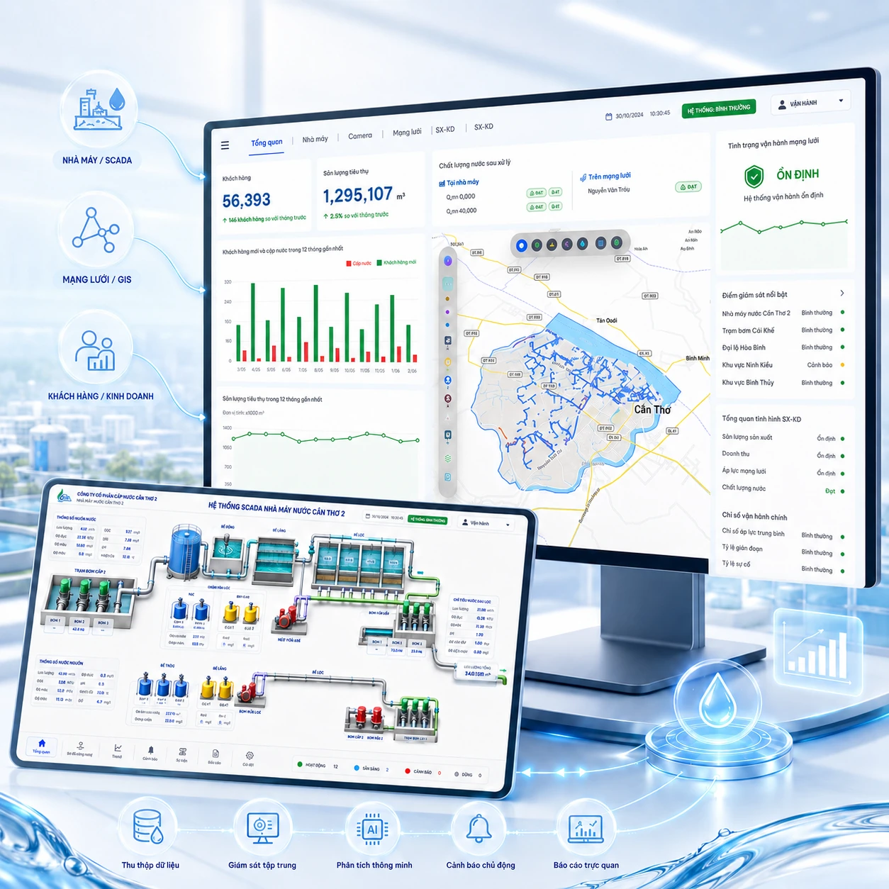
WETEC built a central monitoring interface for water utilities and treatment plants, connecting existing supervisory control and data acquisition (SCADA), geographic information system (GIS), logger, camera, and business-system data. The dashboard brings plant and network measurements, maps, and camera views together so operators can review conditions in one place and coordinate responses. It displays alerts when operating measurements cross configured thresholds, helping staff investigate issues using related locations and field information. The solution has been deployed at BIWASE Binh Phuoc, Phu An, Kien An, and Can Tho 2.
Illustration. Field sources connected to a shared monitoring view.
Connect plant SCADA, network, water-quality and camera data in one monitoring interface.
Organization: Water utilities and treatment plants.
Bringing separate systems into one operating view
SCADA means supervisory control and data acquisition: a plant system for monitoring equipment and water-treatment processes. GIS places network information on a map, while loggers record field measurements. When these sources, cameras and water-quality information sit in separate interfaces, dispatchers must open several systems to understand a situation. WETEC built a central monitoring interface connected to existing sources, providing shared context across the plant and network.
Challenges to address
Operational data was scattered across SCADA, GIS, loggers, cameras and business systems.
Teams lacked one tool to consolidate data and raise smart alerts for timely decisions.
What WETEC delivered
The work includes data-source integration and a dashboard adapted to monitoring needs. Measurements, maps and cameras share one interface with threshold alerts. The solution has been deployed at BIWASE Binh Phuoc, Phu An, Kien An and Can Tho 2.
Deploy a centralized monitoring dashboard that brings operational data into one visual interface.
Connect plant, network, device, logger, map and camera data for a full-system view of water supply.
How the workflow connects
Connect sources. Collect information from plant SCADA, GIS, loggers and field cameras.
Monitor centrally. Operators see measurements and locations within one monitoring interface.
Review alerts. The system shows alerts when operating measurements cross configured thresholds.
Check and coordinate. Staff compare measurements, camera views and locations to respond.
Connecting plant information with network measurement points
An alert is more useful when operators can see its location, related measurements and field camera views. Plant data supports treatment-process monitoring, while GIS and loggers add network context. Camera views help dispatchers investigate and coordinate with the responsible team.
Delivery outcomes
Operators have a central interface for plant and network information, connected monitoring systems and threshold alerts. Managers and dispatchers have an additional tool for reviewing conditions and addressing situations that need attention.
Monitor plant and network data on a shared interface.
Connect SCADA, GIS and field-measurement data.
Support alerts when operating readings exceed thresholds.

Ready to modernize your water utility operations?
WETEC engineers are ready to survey, advise on DMA zoning, GIS digitization, and tailored non-revenue water mitigation strategies.