

GIS ran locally, making remote and mobile access difficult
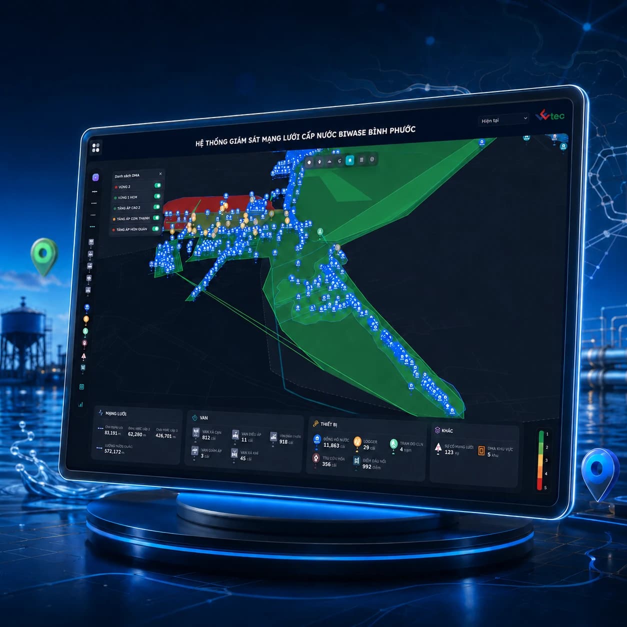
Network asset management on GIS
More than 100,000 network assets on one digital map
Digitized 100,000+ pipeline assets, valves, and DMAs onto an interactive spatial map, integrating live sensor telemetry for NRW reduction.
CustomerBIWASE Binh Phuoc & Utilities
GIS network operations
- 100,000+ assets digitized
- Web and mobile app
- Real-time data
Operating challenge
From local GIS to a web platform
The old GIS only worked inside the office, and data was scattered and inconsistent. WETEC moved every pipe, valve, meter and DMA onto a web-based GIS platform connected to pressure and flow data from IoT devices. Operators gained a tool for locating incidents, and field staff look up and update records on their phones.
Data was scattered, manual and inconsistent across internal systems
The interface was hard to use and missing key operating functions
WETEC’s approach
What WETEC delivered
The scope of work WETEC carried out on the project.
- 01
Asset map
Build GIS as the central data layer for devices, pipes, DMAs, loss management and incidents
- 02
Connected device data
Integrate data from loggers, smart meters and water-quality monitoring, with AI detecting anomalies automatically
Delivery outcomes
Results
Over 100,000 water distribution network assets mapped and fully digitized
Connected pressure and flow data to support incident localization
Enabled field crews to query, inspect and update asset condition data directly on mobile
Products used
WETEC products in this project


Facing a similar problem?
WETEC is ready to advise, free of charge, on the solution and roadmap that fit your utility.